Charleston, South Carolina – After years of petitioning, the State of South Carolina Department of Transportation decided to include a pedestrian walkway in the designs for a new Cooper River Bridge. When the new bridge was finished, the walkway became overnight success that provided people the first ever dedicated pedestrian path between Charleston and Mt. Pleasant. Totaling around 2.4 miles (One-way), the walk ascends a strenuous 190′ to cross the shipping channel and then descends the same amount and can be finished in around 50 minutes (One-way).
Trail Description
Due to the ease of parking in Mt. Pleasant, it is usually best to begin on that side of the bridge. After parking either in the designated and signed lot or along Patriots Point Rd, follow the sidewalk to Coleman Blvd. Continue up Coleman on the sidewalk past the gas station and hotel on the harbor side of the road and the bridge will begin shortly. The initial climb out of Mt. Pleasant is a steep one to the first bridge tower, however once there it is possible to sit for a rest and enjoy the view of the harbor and Charleston Peninsula.
Continuing on and crossing the main span will be next. It really is powerful to stand at the center point and get a perspective of just how large container ships are these days. Continuing on, there will be another rest point at the western tower before the long and slow descent onto the Charleston Peninsula. The slope is much less on this side of the main span as you cross Drum Island and follow the on-ramp down to East Bay Street. From here you can continue on past the port yard and to the heart of Historic Charleston.
A high metal fence keeps people from falling 200 feet down into the harbor while on the bridge. On the other side of the walkway though, a relatively short concrete barrier is all that separates you from the road and cars or trucks moving at highway speeds. That can be a little intimidating at first but is just a condition of the bridge one has to accept. The pathway is divided into pedestrian and bike lanes so be cautious of which side you are on in order keep space open for faster moving bikers.
The bridge walk is an excellent weekend or evening activity in nice weather but be cautious as winds can be especially fierce high up on the bridge, especially during pop-up summer thunderstorms.
Trail Data
[gps-data-up distance=”2.4″ elevationdifference=”190″ climb=”190″ descent=”180″ time=”50 minutes one-way”]Trail Map
[gps-iframe urlbase=”cooperriver_bridge/cooperriver_bridge” height=”496″]Trail Elevation Profile
[gps-elevation trailname=”Cooper River Bridge Walk” urlbase=”cooperriver_bridge/cooperriver_bridge”]Trail Photos
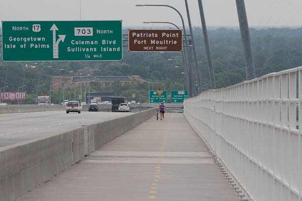
The walkway as it slopes up from Mt. Pleasant
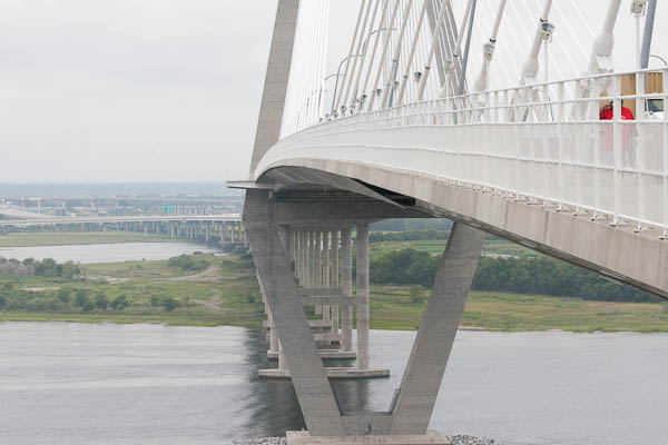
The long span over the Cooper River
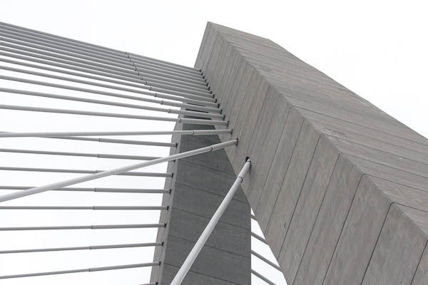
View up the eastern tower
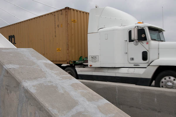
A truck blowing past me at 50+ MPH

The jurisdiction sign at the center of the main span